Qom
 |
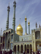
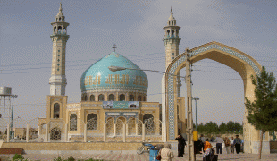
Qom is considered holy in Shi'a Islam, as it is the site of the shrine of Fatimah bint Musa, sister of Imam Ali ibn Musa Rida (Persian: Imam Reza; 789–816). The city is the largest center for Shi'a scholarship in the world, and is a significant destination of pilgrimage, with around twenty million pilgrims visiting the city every year, the majority being Iranians but also other Shi'a Muslims from all around the world. Qom is also famous for a Persian brittle toffee known as sohan (Persian: سوهان), considered a souvenir of the city and sold by 2,000 to 2,500 "sohan" shops.
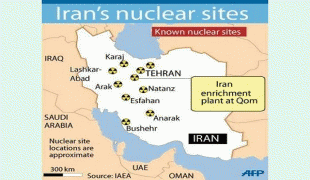
Qom has developed into a lively industrial center owing in part to its proximity to Tehran. It is a regional center for the distribution of petroleum and petroleum products, and a natural gas pipeline from Bandar Anzali and Tehran and a crude oil pipeline from Tehran run through Qom to the Abadan refinery on the Persian Gulf. Qom gained additional prosperity when oil was discovered at Sarajeh near the city in 1956 and a large refinery was built between Qom and Tehran.
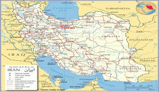
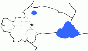
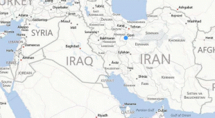
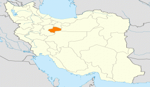
Qom, the capital of Qom province, is located 125 kilometers south of Tehran, on a low plain. The shrine of Fatimeh Masumeh, the sister of Imam Reza, is located in this city, which is considered by Shiʿa Muslims holy. The city is located in the boundary of the central desert of Iran (Kavir-e Markazi). At the 2011 census its population was 1,074,036, comprising 545,704 males and 528,332 females.
Qom is a focal center of the Shiʿah. Since the revolution, the clerical population has risen from around 25,000 to more than 45,000 and the non-clerical population has more than tripled to about 700,000. Substantial sums of money in the form of alms and Islamic taxes flow into Qom to the ten Marja'-e taqlid or "Source to be Followed" that reside there. The number of seminary schools in Qom is now over fifty, and the number of research institutes and libraries somewhere near two hundred and fifty.
Its theological center and the Fatima Masumeh Shrine are prominent features of Qom. Another very popular religious site of pilgrimage formerly outside the city of Qom but now more of a suburb is called Jamkaran. Qom's proximity to Tehran has allowed the clerical establishment easy access to monitor the affairs and decisions of state. Many Grand Ayatollahs possess offices in both Tehran and Qom; many people simply commute between the two cities as they are only 156 km apart. Southeast of Qom is the ancient city of Kashan. Directly south of Qom lie the towns of Delijan, Mahallat, Naraq, Pardisan City, Kahak, and Jasb. The surrounding area to the east of Qom is populated by Tafresh, Saveh, and Ashtian and Jafarieh.
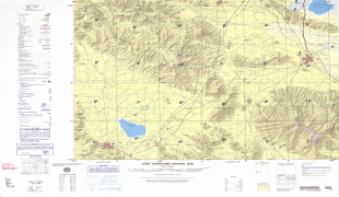
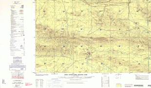
Map - Qom


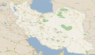

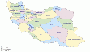
Country - Iran
 |
 |
| Flag of Iran | |
The country is home to one of the world's oldest civilizations, beginning with the formation of the Elamite kingdoms in the fourth millennium BC. It was first unified by the Medes, an ancient Iranian people, in the seventh century BC, and reached its territorial height in the sixth century BC, when Cyrus the Great founded the Achaemenid Persian Empire, which became one of the largest empires in history and a superpower. The Achaemenid Empire fell to Alexander the Great in the fourth century BC and was subsequently divided into several Hellenistic states. An Iranian rebellion established the Parthian Empire in the third century BC, which was succeeded in the third century AD by the Sassanid Empire, a major world power for the next four centuries. Arab Muslims conquered the empire in the seventh century AD, which led to the Islamization of Iran. It subsequently became a major center of Islamic culture and learning, with its art, literature, philosophy, and architecture spreading across the Muslim world and beyond during the Islamic Golden Age. Over the next two centuries, a series of native Iranian Muslim dynasties emerged before the Seljuk Turks and the Mongols conquered the region. In the 15th century, the native Safavids re-established a unified Iranian state and national identity, and converted the country to Shia Islam. Under the reign of Nader Shah in the 18th century, Iran presided over the most powerful military in the world, though by the 19th century, a series of conflicts with the Russian Empire led to significant territorial losses. The early 20th century saw the Persian Constitutional Revolution. Efforts to nationalize its fossil fuel supply from Western companies led to an Anglo-American coup in 1953, which resulted in greater autocratic rule under Mohammad Reza Pahlavi and growing Western political influence. He went on to launch a far-reaching series of reforms in 1963. After the Iranian Revolution, the current Islamic Republic was established in 1979 by Ruhollah Khomeini, who became the country's first Supreme Leader.
Currency / Language
| ISO | Currency | Symbol | Significant figures |
|---|---|---|---|
| IRR | Iranian rial | ï·¼ | 2 |
| ISO | Language |
|---|---|
| KU | Kurdish language |
| FA | Persian language |